Reunion Island: A Desert Landscape Leading to the Indian Ocean's Most Active Volcano
A Unique Landscape on the Way to a Volcano
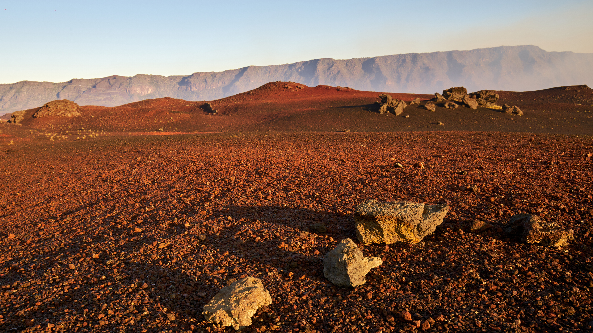
Nestled at an altitude of nearly 2,300 meters, the Plaine des Sables desert offers a striking contrast to the lush greenery found elsewhere on Reunion Island. This vast reddish plateau is often described as moon-like, creating a dramatic transition as visitors approach Piton de la Fournaise, one of the most active volcanoes in the world. Before embarking on the climb up the volcano, travelers pass through this unique landscape, which serves as the final stop on the journey.
The Volcano Forest Road: A Scenic Route
To reach the Plaine des Sables, travelers can take the famous Volcano Forest Road (RF5), a winding and panoramic route that leads through diverse landscapes toward Piton de la Fournaise. Starting from Bourg-Murat, the road gradually ascends through the green pastures of the Hautes Plaines. Along the way, it passes by the pastures of the Plaine des Cafres, offering breathtaking views from the Nez de Bœuf, a high point that overlooks the Remparts river. The path then winds past the Commerson crater, a massive cavity formed by an ancient eruption. After about eight kilometers, the Plaine des Sables finally comes into view, marking one of the most extraordinary sights of the entire journey.
A Desert-Like Expanse Shaped by Volcanic Activity
The Plaine des Sables is unlike any other area on the island. Its vast, almost desert-like expanse is devoid of trees, with only a few hardy plants such as the ambavilla and lichens managing to survive. The terrain is uneven, covered in black slag, broken ridges, and volcanic sand, gravel, and solidified lava flows. This area is not a true plain but rather the bottom of a filled caldera formed during an ancient collapse. It has been covered by material ejected from Piton de la Fournaise over time.
On the right side of the road, Piton Haüy stands isolated on a hillock, while Formica Léo, a small reddish dome, can be reached on foot within minutes. There are no signposts or facilities for visitors, making the experience all the more immersive. Travelers can park along the roadside, walk on the loose pumice, and observe the layers of volcanic rock that tell the story of one of the most active volcanoes on Earth. The two-kilometer stretch leaves a lasting impression, transitioning from the humid vegetation of the island to a stark, mineral-rich landscape.
A Gateway to the Summit of Piton de la Fournaise
At the end of the Plaine des Sables, the road leads to the Bellecombe-Jacob pass, located at an altitude of 2,311 meters. This natural viewpoint offers an exceptional panoramic view of the Enclos Fouqué, a massive caldera containing the active cone of Piton de la Fournaise. From here, several marked trails lead to the summit of the volcano, with the most popular route being the most direct. This trail begins by descending toward the Enclos Fouqué before gradually climbing back up, following white markings painted on the solidified lava flows. The hike typically takes around five hours round-trip and provides an unforgettable experience for adventurers.

Post a Comment