Reunion Island: Three Majestic Cirques Define Its Stunning Landscapes
The Natural Wonders of Reunion Island
Reunion Island, a French territory in the Indian Ocean, is home to some of the most breathtaking natural landscapes in the world. At its heart lies the mountainous core formed by the collapse of the Piton des Neiges massif. This geological event gave rise to three remarkable cirques: Cilaos, Mafate, and Salazie. These rocky amphitheaters are surrounded by steep natural ramparts and offer a diverse range of environments, from lush tropical forests and rugged ridges to hilltop villages and challenging hiking trails.
Salazie: A Green Paradise
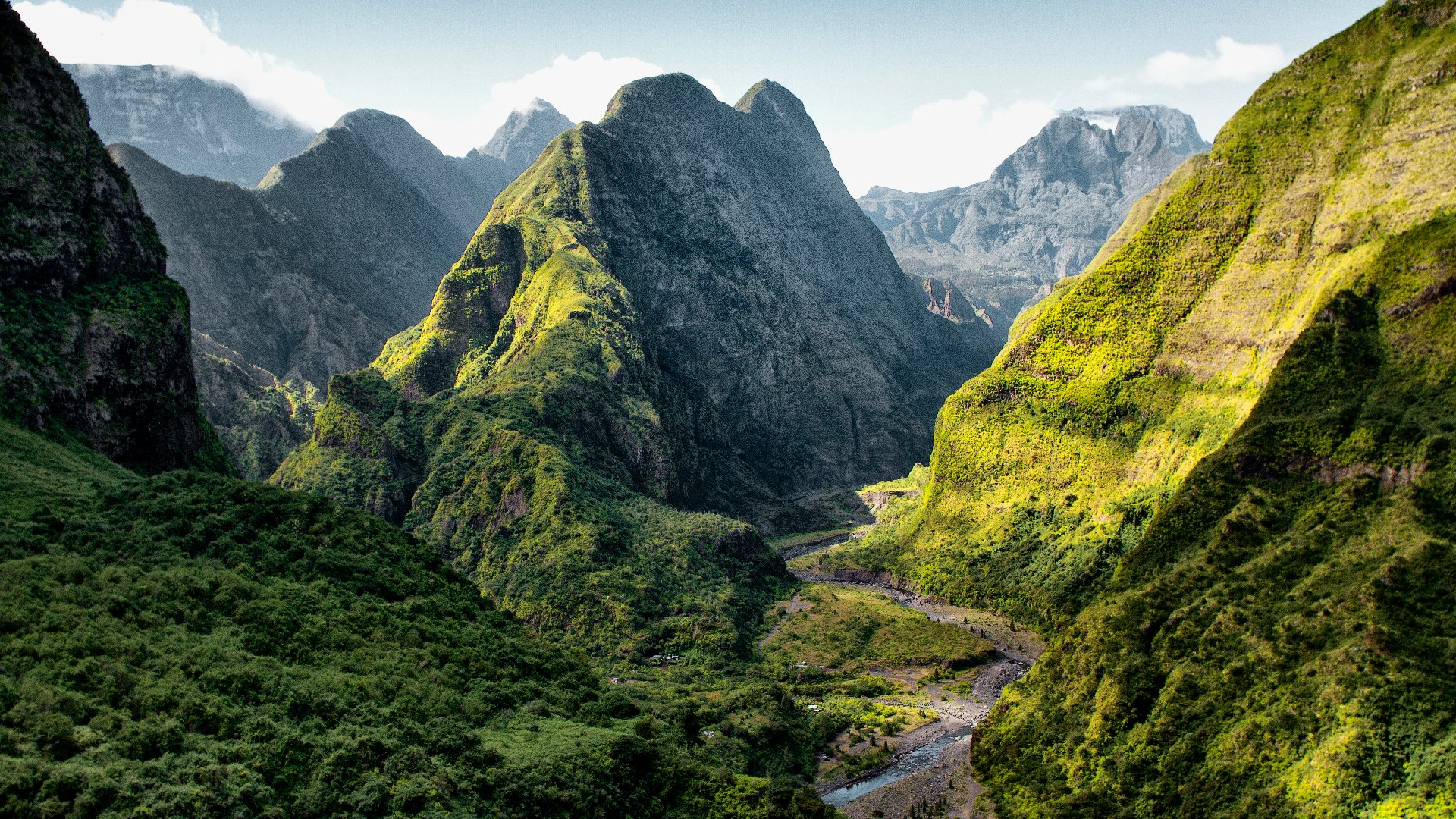
Salazie is often described as the greenest of the three cirques. To explore this area, travelers can take the route along the northeastern coast of Reunion, following the Mât River as it carves through a narrow gorge. As the path winds under towering cliffs, the landscape becomes increasingly dense with vegetation. The air is thick with humidity, and the sounds of cascading waterfalls fill the atmosphere.
One of the most iconic sights in Salazie is the Voile de la Mariée (The Bride’s Veil), a waterfall that plunges more than 200 meters down a wall covered in creepers and lianas. Even during the dry season, the paths remain muddy, and the homes in the region must contend with persistent moisture and moss growth.
In the heart of the cirque, the village of Hell-Bourg stands out with its old Creole houses featuring intricate cornices. Recognized as one of the 'Most Beautiful Villages in France,' Hell-Bourg offers a glimpse into a past era when it was a thermal village. Visitors can explore Villa Folio, a fine example of 19th-century bourgeois architecture, and the ruins of the original baths.
A short drive from Hell-Bourg leads to the Col des Bœufs, a high point at 1,956 meters. From here, hikers can descend into La Nouvelle, a small town accessible after a 2.5-hour walk and a 600-meter descent. This journey marks a shift in pace and terrain, offering a different perspective on the region's beauty.
Mafate: A Hidden Gem
Mafate is the most isolated of the three cirques, accessible only by foot or helicopter. This protected area, part of Reunion National Park and a UNESCO World Heritage Site, spans over 140 square kilometers and is home to a dozen small hamlets. These communities live in near-total autonomy, with their own schools, solar panels, and vegetable gardens.
The most dramatic entrance to Mafate is via Piton Maïdo, where visitors can drive up to 2,200 meters before beginning a three-hour descent to Roche Plate. Another popular route leads to Marla, taking five to six hours of walking depending on the path. Experienced hikers can complete the entire circuit in three to four days, covering a total elevation gain of 2,500 meters.
Cilaos: A Popular Destination
Cilaos, the most accessible of the three cirques, is located on the southern side of the island. The famous 'road of 400 bends' offers a challenging drive through metal bridges, narrow tunnels, and tight hairpin turns. After about 35 kilometers, travelers reach a village known for its thermal baths, bustling market, embroidery workshops, and family-run hotels.
This village serves as a hub for several hiking routes, including the GR R1, which circles the Piton des Neiges, and the GR R2, which crosses the island from north to south. One notable trail is the Taïbit Pass, which connects Cilaos to Mafate in four to five hours of hiking. The path climbs to 2,082 meters before descending toward Marla, passing through terraced crops and pine and eucalyptus forests.
Another ambitious goal for hikers is the peak of Piton des Neiges, the highest point on the island at 3,070 meters. The trek requires two days, with an overnight stay at the Caverne Dufour refuge. Hikers then climb before dawn to witness the sunrise from the summit, offering panoramic views of the three cirques, the southern plains, and even the ocean on clear days.

Post a Comment